Property Record
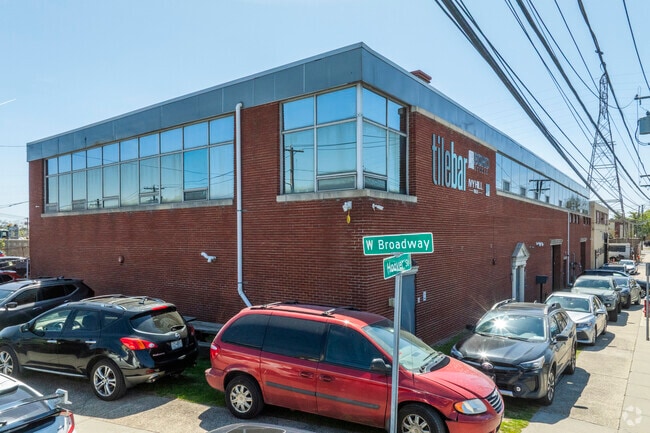
15 Hoover St, Inwood, NY 11096
NEARBY LISTINGS FOR SALE OR LEASE
-
-
-
-
230-39 International Airport Ctr Blvd
Springfield Gardens, NY 11413
Negotiable
6,019 - 14,216 SF
Flex
-
View all Inwood listings for sale on LoopNet.com
Property Detail
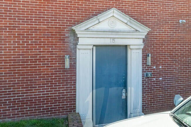
15 Hoover St
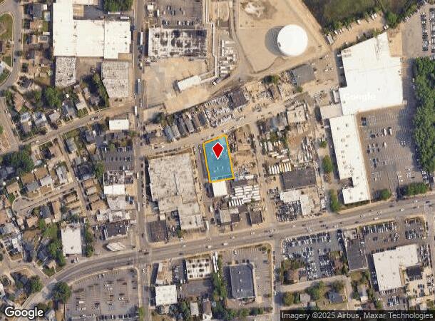
Nassau County-Suffolk County, NY
Map Of Property At Inwood
2089-40-016-00-0001-0
1-5,38-40
Warehouse
Nassau
AE
New York
36059C0301G
1
2025
0.40 AC
2025
Southern Nassau
411000
Long Island (New York)
36,975 SF
DEMOGRAPHICS near 15 Hoover St
1 Mile
3 Mile
5 Mile
2024 Total Population
19,015
160,493
442,355
2029 Population
18,283
152,586
418,069
Pop Growth 2024-2029
(3.85%)
(4.93%)
(5.49%)
Average Age
36
39
41
2024 Total Households
5,513
50,061
143,673
HH Growth 2024-2029
(3.86%)
(5.07%)
(5.66%)
Median Household Inc
$76,059
$79,654
$88,805
Avg Household Size
3.20
3.00
2.90
2024 Avg HH Vehicles
2.00
1.00
1.00
Median Home Value
$711,014
$724,617
$648,726
Median Year Built
1952
1959
1956
Nearby Places
- Restaurants
- Banks
- Shops
- Fitness
- Groceries
PUBLIC TRANSPORTATION
TRANSIT/SUBWAY
Inwood Station (Far Rockaway Branch - Long Island Rail Road)
DRIVE
WALK
Distance
Inwood Station (Far Rockaway Branch - Long Island Rail Road)
2 min
19 min
0.9 mi
Lawrence Station (Far Rockaway Branch - Long Island Rail Road)
DRIVE
WALK
Distance
Lawrence Station (Far Rockaway Branch - Long Island Rail Road)
3 min
19 min
1.0 mi
COMMUTER RAIL
Inwood Station (Far Rockaway Branch - Long Island Rail Road)
DRIVE
WALK
Distance
Inwood Station (Far Rockaway Branch - Long Island Rail Road)
2 min
17 min
0.9 mi
Lawrence Station (Far Rockaway Branch - Long Island Rail Road)
DRIVE
WALK
Distance
Lawrence Station (Far Rockaway Branch - Long Island Rail Road)
3 min
19 min
1.0 mi
AIRPORT
John F Kennedy International
DRIVE
WALK
Distance
John F Kennedy International
17 min
8.5 mi
LaGuardia
DRIVE
WALK
Distance
LaGuardia
26 min
14.2 mi
Newark Liberty International
DRIVE
WALK
Distance
Newark Liberty International
53 min
34.0 mi
Freight Ports
NY - Red Hook Container Terminal
DRIVE
WALK
Distance
NY - Red Hook Container Terminal
37 min
18.4 mi
Nearby Properties
Address
Land Use
TOTAL SIZE
Lot Size
Zoning
Address
Land Use
TOTAL SIZE
Lot Size
Zoning
14,417,607 SF
4,921.45 AC
M1-1
Address
Land Use
TOTAL SIZE
Lot Size
Zoning
229.51 AC
PARKUS
Address
Land Use
TOTAL SIZE
Lot Size
Zoning
111.98 AC
PARK
Address
Land Use
TOTAL SIZE
Lot Size
Zoning
182.50 AC
M1-1
Address
Land Use
TOTAL SIZE
Lot Size
Zoning
72,663 SF
264.48 AC
PARK
Address
Land Use
TOTAL SIZE
Lot Size
Zoning
124.60 AC
M1-1
Address
Land Use
TOTAL SIZE
Lot Size
Zoning
294.47 AC
PARK
Address
Land Use
TOTAL SIZE
Lot Size
Zoning
52.80 AC
PARK
Address
Land Use
TOTAL SIZE
Lot Size
Zoning
32.47 AC
PARK
Address
Land Use
TOTAL SIZE
Lot Size
Zoning
188,656 SF
5.78 AC
R5
Address
Land Use
TOTAL SIZE
Lot Size
Zoning
820,910 SF
21.03 AC
R4
Address
Land Use
TOTAL SIZE
Lot Size
Zoning
188.92 AC
PARK
Address
Land Use
TOTAL SIZE
Lot Size
Zoning
27.23 AC
PARK
Address
Land Use
TOTAL SIZE
Lot Size
Zoning
160,000 SF
4.02 AC
R3-2
Address
Land Use
TOTAL SIZE
Lot Size
Zoning
661,319 SF
50.43 AC
R5
Address
Land Use
TOTAL SIZE
Lot Size
Zoning
93.35 AC
PARK
Address
Land Use
TOTAL SIZE
Lot Size
Zoning
587,170 SF
13.55 AC
R4
Address
Land Use
TOTAL SIZE
Lot Size
Zoning
14.91 AC
C4-4
Address
Land Use
TOTAL SIZE
Lot Size
Zoning
154,051 SF
4.05 AC
R5
Address
Land Use
TOTAL SIZE
Lot Size
Zoning
119,788 SF
3.90 AC
R5
Address
Land Use
TOTAL SIZE
Lot Size
Zoning
178,870 SF
7.60 AC
M1-1
Address
Land Use
TOTAL SIZE
Lot Size
Zoning
5,296 SF
37.42 AC
PARK
Address
Land Use
TOTAL SIZE
Lot Size
Zoning
213,338 SF
2.91 AC
R3X
Address
Land Use
TOTAL SIZE
Lot Size
Zoning
449,000 SF
5.15 AC
R6
Address
Land Use
TOTAL SIZE
Lot Size
Zoning
128,000 SF
2.52 AC
R5
Address
Land Use
TOTAL SIZE
Lot Size
Zoning
155,875 SF
0.90 AC
R6
Address
Land Use
TOTAL SIZE
Lot Size
Zoning
6,077 SF
19.66 AC
PARK
Address
Land Use
TOTAL SIZE
Lot Size
Zoning
97,190 SF
1.75 AC
R3X
Address
Land Use
TOTAL SIZE
Lot Size
Zoning
358,140 SF
8.13 AC
R5
Address
Land Use
TOTAL SIZE
Lot Size
Zoning
16.49 AC
PARK
The World's #1 Commercial Real Estate Marketplace
Connect with us
© 2025 CoStar Group
The information above has been obtained from sources believed reliable. While we do not doubt its accuracy we have not verified it and make no guarantee, warranty or representation about it. It is your responsibility to independently confirm its accuracy and completeness. Any projections, opinions, assumptions, or estimates used are for example only and do not represent the current or future performance of the property. The value of this transaction to you depends on tax and other factors which should be evaluated by your tax, financial, and legal advisors. You and your advisors should conduct a careful, independent investigation of the property to determine to your satisfaction the suitability of the property for your needs.